The "What Are You Working On?" Thread
- Thread starter garyjpaterson
- Start date


Latest News
-
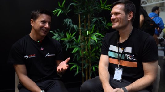
 WATCH: Hopping Into Conspit's F1 Rig At SimRacing ExpoConspit is a relative newcomer in the world of sim racing hardware - but that does not mean they...
- Yannik Haustein
- Updated:
- 1 min read
-
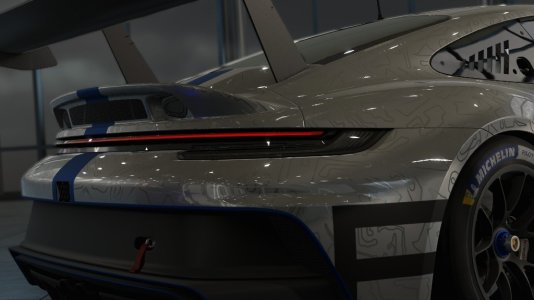
 Forza Horizon 5 Collaborates With Halo For Update 40From a varied range of new Porsches to a collaboration from the stars; Forza Horizon 5's latest...
- Connor Minniss
- Updated:
- 2 min read
-
Le Mans Ultimate Teases LMGT3 Cars To Be "Coming Soon"The 2024 grid will continue to take shape in Le Mans Ultimate: The first batch of LMGT3 cars is...
- Yannik Haustein
- Updated:
- 2 min read
-
Assetto Corsa Competizione Ultimate: New Bundle Includes Game, All DLCThe sim might be on its way out, but a new Ultimate Edition still makes Assetto Corsa...
- Yannik Haustein
- Updated:
- 2 min read
-
 Race 2024 NASCAR in Forza Motorsport Update 14 & American Thunder TourTo celebrate the final round of the NASCAR Cup Series at Phoenix, Turn 10 Studios have added the...
- Luca Munro
- Updated:
- 2 min read
-
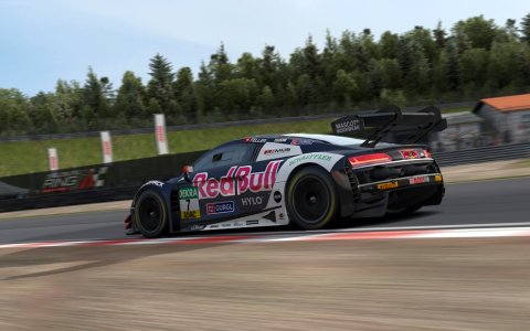
2024 Brazilian Grand Prix Community RecapAfter one of the most chaotic, action-packed and awe-inspiring race weekends of the Formula One...
- Connor Minniss
- Updated:
- 4 min read
-
Test Drive Unlimited: Solar Crown Players To Receive In-game CompensationIn the latest patch announcement for Test Drive Unlimited: Solar Crown (TDUSC), compensation for...
- Connor Minniss
- Updated:
- 2 min read