You are using an out of date browser. It may not display this or other websites correctly.
You should upgrade or use an alternative browser.
You should upgrade or use an alternative browser.
Tracks WIP - Santa Monica Mountains
- Thread starter Todd K
- Start date
mod-edit: stop the trolling mate. Don't like it, move on...
Last edited by a moderator:
Friendly reminder:I think we already have too much these mountain roads and 1 is enough, thought, all these are so similar. So why do you wast your time for this crap??? Just make conversions for some great race tracks like Rattle Snake Point, that's something cool.
Modders do what pleases them.
They are not some sort of genie in the lamp
And they certainly are not here to fullfill wishes to spoiled, ungrateful brats
Also revise your adjectives, as this project is using interesting techniques that could very much change the game of track modding in the coming years
I think we already have too much these mountain roads and 1 is enough, thought, all these are so similar. So why do you wast your time for this crap??? Just make conversions for some great race tracks like Rattle Snake Point, that's something cool.
Why are you even here?
Please don't listen to that guy Kimmo - he knows no better and I like others here are watching out for what's going on with this *and Ben Bro's Island*
All good, thanks guys. I'm glad most are digging it and are excited for more!
I haven't driven TOO far and wide I'll admit, but of the scenic roads I have had the pleasure to drive on, these are at the very top of my list. It's my desire to share these roads with you, and can only hope that I'm able to capture even a fraction of the magic that makes them so enjoyable to me in real life.
P.S. Remember to always drive safely and respectfully
Last edited:
Coming here after looking closely at Topanga and Snake. I should tell you that you won't be able to mask any of the terrain holes with vegetation - conventional or FX.I'll definitely do a pass of smoothing out a lot of the biggest offenders, but my plan/hope is to hide most of the nasty stuff with trees, bushes, and really large GrassFX
Even worse - when the player is below the road edge and looks up sees trees and grass levitating.
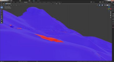
So the most reliable and energy-efficient way of dealing with that problem is raising parts of the terrain with shrinkwrap "project" and extruding the outer edges of the near-field mesh vertically down to meet the terrain halfway. Something like this (for the start of The Snake)
It may stray from the real life road a lot but at least looks believable. If you strive a lot to maintain the topology true you may try shrinkwrapping the near ground down onto the terrain. The Snake reveals another problem with the near-field ground and that is too small and dark capture. I don't know if you have tried flying drones but it may be the answer for capturing the images for near-field ground. The road and gutter in their current state are exactly what's needed for great driving experience. The approach of using photogrammetry for track mesh is welcome. But the shortcomings that come with it may spoil the magic if not taken care of.
Attachments
Last edited:
Thanks for your insights alekabul. You bring up what is definitely the #1 issue I have yet to figure out. How to cleanly and easily blend the foreground and background terrain. I appreciate all input and suggestions.
I have indeed done some tests trying to shrink wrap the background terrain to the road using vertex soft selection. The main issue I ran into is that once the two are shrink wrapped together, it results in a significant amount of interpenetration since the background terrain geo is much lower res. This is very labor intensive to clean up manually, and the end results were not clean enough to justify that kind of effort. It certainly has merit, but my technique was a bit flawed I think!
Another approach I've considered is to extrude the edges of my foreground road geo, conform it to the background terrain, and then smooth the bridging polygons. I then must UV this new geo, and run 3 different texture bakes:
01) Bake background terrain textures to new UV space
02) Bake foreground photogrammetry textures to new UV space
03) Bake a distance falloff map in order to blend the two
It does produce clean and nearly seamless results, but again, it does feel a bit labor intensive in the small isolated tests I've done. I need to attempt it on much larger sections of road to truly vet it. The big down side is that it significantly increases the amount of UV space required, depending on how large the extrusion distance is.

Your mention of drone photography is definitely something that has crossed my mind. I am quite interested in exploring this, but at the moment I don't have the access or know anybody who does. I do believe that a drone flown along the road at about a 15 foot height would produce great results. It would likely capture all the same road detail I'm currently getting, and also expand out the edges in most areas. The legality of doing that is another story though, I suppose!
In any case, if anybody in the LA area has a drone capable of carrying a GoPro, definitely send me a PM please
I have indeed done some tests trying to shrink wrap the background terrain to the road using vertex soft selection. The main issue I ran into is that once the two are shrink wrapped together, it results in a significant amount of interpenetration since the background terrain geo is much lower res. This is very labor intensive to clean up manually, and the end results were not clean enough to justify that kind of effort. It certainly has merit, but my technique was a bit flawed I think!
Another approach I've considered is to extrude the edges of my foreground road geo, conform it to the background terrain, and then smooth the bridging polygons. I then must UV this new geo, and run 3 different texture bakes:
01) Bake background terrain textures to new UV space
02) Bake foreground photogrammetry textures to new UV space
03) Bake a distance falloff map in order to blend the two
It does produce clean and nearly seamless results, but again, it does feel a bit labor intensive in the small isolated tests I've done. I need to attempt it on much larger sections of road to truly vet it. The big down side is that it significantly increases the amount of UV space required, depending on how large the extrusion distance is.
Your mention of drone photography is definitely something that has crossed my mind. I am quite interested in exploring this, but at the moment I don't have the access or know anybody who does. I do believe that a drone flown along the road at about a 15 foot height would produce great results. It would likely capture all the same road detail I'm currently getting, and also expand out the edges in most areas. The legality of doing that is another story though, I suppose!
In any case, if anybody in the LA area has a drone capable of carrying a GoPro, definitely send me a PM please
Last edited:
I noticed there is some spill-over on The Snake and took measures against that by using "Multiresolution" modifier in conjunction with projecting. The remaining sporadic spills are done with one by one but it is much less labor intensive than the alternative in your example.issue I ran into is that once the two are shrink wrapped together, it results in a significant amount of interpenetration
Then the edges - there are two options:
and use on that a single separate material with appropriate shader. Or option 2:
deselectind edges along the road and moving the remaining non-manifold edges instead of extruding from them rids you of the need for dealing with material issues altogether. Only the separating of pieces by material is left to do and Blender does it in a jiffy
Last edited:
@Todd K Can you please please please please PLEASEEE do the stretch of Tuna Canyon from Topanga Canyon up to Saddle Creek? I used to live on top of Tuna Canyon and I have literally been dreaming of doing what you are doing with that stretch of road since I got my VR motion simulator a few months ago. I love that you already did the stretch down to PCH and I cannot wait to try that out! (Topanga Canyon Rd from PCH would be awesome, too!)
Let me know if you need help capturing some more roads. Happy to donate my time and driving to your project!!
Let me know if you need help capturing some more roads. Happy to donate my time and driving to your project!!
@Todd K This is truly amazing stuff. I used to drive a mountain loop in the Santa Cruz mountains between SR9 and SR17 on a regular basis and wanted to recreate it in Assetto Corsa. I started off with google map data and trying to manually rebuild the roads using RaceTrackBuilder, but the results were pretty poor.
Photogrammetry seems like an ideal way to capture this data but I was wondering if you could comment on two aspects that I was curious about
1) SR17 is pretty much busy 24/7. How does your process deal with other cars on the road. Do moving objects get detected and removed as it compares frames or do you have to do manual cleanup for those?
2) A lot of this Santa Cruz mountain roads are completely surrounded by trees even to the extend of having the canopy cover the top of the road. Does this cause issues for track generation, since it's basically a tunnel?
Keep up the awesome work!
Hey @sdether thanks for your comments, glad to hear you are digging it and are inspired by the methodology.
Very cool, I was just recently up near Santa Cruz and did a quick pass through that very same stretch, along with a few of the twisty side streets. I've always thought the roads in that area looked like fun on the map, and it did not disappoint! I'm heading up to Monterey to watch the Rolex Motorsports Reunion in August and plan to go back up past Santa Cruz one afternoon to enjoy more of those roads. Really beautiful scenery, lots to explore, let me know if you have any other favorite stretches.
To answer your questions:
1) I was worried about moving objects such as cars being an issue, and they certainly were in my very early tests when I was using multiple non-360 cameras. I was having to mask them out or else they would cause errors the photo alignment. Luckily though, after switching to the 360 cam approach, they seem to be a non-issue. Here's a screenshot of what a passing car tends to show up as. A hovering blob that can easily be selected and deleted:

Static cars do get baked in as part of the geometry through. They have to be manually smoothed away and painted from the textures. Individual cars are not too bad a problem, but if you have a whole street lined with parked cars, you won't be able to get any of the shoulder detail since the cars will be in the way.
2) Trees on the other hand are indeed REALLY annoying. They're super messy, super dense, and require a lot of labor to clean up. What I've been doing is deleting all the totally unusable polygons, and then relaxing the heck out of the remaining geometry to the point where it can become the ground terrain. This sometimes tends to result in creating geometry that looks like you're driving through a narrow canyon, which is something I have to watch out for and manually adjust in the worst cases.
Section of road as generated by photogrammetry:

Before and after I do my cleanup and smoothing process:


Another example of before/after tree cleaning:


Cleaning up the tree geo like this is the #1 most tedious part of the whole process. I've done some tests masking out the trees BEFORE the photogrammetry is run so that they're not even generated, which certainly does help clean up the mesh.
That might sound like the way to go, but for my purposes I ran into a couple of issues with it. One issue being that the only real way to procedurally mask the trees is to key out all the "green" color data from the video frames. This results in not only trees getting removed, but also bushes and grass which leads to very dull looking textures with nowhere for GrassFX to spawn. The other issue is that it trims away a lot of the surrounding geometry, leaving a pretty narrow strip of just the road + dirt shoulders. Look at my screenshot just above and imagine all the green sections being gone, leaving only the dirt and road.
I think that would definitely be useful in some cases, especially if you're just using it for reference to reconstruct everything. For my current needs though I felt it left me with too little geometry to be able to integrate with the background terrain, especially since even grass gets lost. I would have to extrude out all the edges and manually reconstruct the ground in most areas.
So in the end I have continued to let it generate the trees and then manually smooth the geometry. At least this leaves me a lot of green in the textures which in turn becomes GrassFX.
I know Agisoft has some clever features for land surveying with aerial photography which will intelligently detect stuff like trees and roads, then allow you to mask stuff out. I did spend some time trying to leverage this, but I couldn't quite figure it out well enough to get decent results so ended up plowing forward without it. I'm certainly interested in exploring that again though as I think it would be useful in many ways.
Anyway, can you tell I like talking about this stuff?
Very cool, I was just recently up near Santa Cruz and did a quick pass through that very same stretch, along with a few of the twisty side streets. I've always thought the roads in that area looked like fun on the map, and it did not disappoint! I'm heading up to Monterey to watch the Rolex Motorsports Reunion in August and plan to go back up past Santa Cruz one afternoon to enjoy more of those roads. Really beautiful scenery, lots to explore, let me know if you have any other favorite stretches.
To answer your questions:
1) I was worried about moving objects such as cars being an issue, and they certainly were in my very early tests when I was using multiple non-360 cameras. I was having to mask them out or else they would cause errors the photo alignment. Luckily though, after switching to the 360 cam approach, they seem to be a non-issue. Here's a screenshot of what a passing car tends to show up as. A hovering blob that can easily be selected and deleted:
Static cars do get baked in as part of the geometry through. They have to be manually smoothed away and painted from the textures. Individual cars are not too bad a problem, but if you have a whole street lined with parked cars, you won't be able to get any of the shoulder detail since the cars will be in the way.
2) Trees on the other hand are indeed REALLY annoying. They're super messy, super dense, and require a lot of labor to clean up. What I've been doing is deleting all the totally unusable polygons, and then relaxing the heck out of the remaining geometry to the point where it can become the ground terrain. This sometimes tends to result in creating geometry that looks like you're driving through a narrow canyon, which is something I have to watch out for and manually adjust in the worst cases.
Section of road as generated by photogrammetry:
Before and after I do my cleanup and smoothing process:
Another example of before/after tree cleaning:
Cleaning up the tree geo like this is the #1 most tedious part of the whole process. I've done some tests masking out the trees BEFORE the photogrammetry is run so that they're not even generated, which certainly does help clean up the mesh.
That might sound like the way to go, but for my purposes I ran into a couple of issues with it. One issue being that the only real way to procedurally mask the trees is to key out all the "green" color data from the video frames. This results in not only trees getting removed, but also bushes and grass which leads to very dull looking textures with nowhere for GrassFX to spawn. The other issue is that it trims away a lot of the surrounding geometry, leaving a pretty narrow strip of just the road + dirt shoulders. Look at my screenshot just above and imagine all the green sections being gone, leaving only the dirt and road.
I think that would definitely be useful in some cases, especially if you're just using it for reference to reconstruct everything. For my current needs though I felt it left me with too little geometry to be able to integrate with the background terrain, especially since even grass gets lost. I would have to extrude out all the edges and manually reconstruct the ground in most areas.
So in the end I have continued to let it generate the trees and then manually smooth the geometry. At least this leaves me a lot of green in the textures which in turn becomes GrassFX.
I know Agisoft has some clever features for land surveying with aerial photography which will intelligently detect stuff like trees and roads, then allow you to mask stuff out. I did spend some time trying to leverage this, but I couldn't quite figure it out well enough to get decent results so ended up plowing forward without it. I'm certainly interested in exploring that again though as I think it would be useful in many ways.
Anyway, can you tell I like talking about this stuff?
Last edited:
Im jealous. I've been to the Monterey Historics many times, but will miss it again this year.Hey @sdether thanks for your comments, glad to hear you are digging it and are inspired by the methodology.
Very cool, I was just recently up near Santa Cruz and did a quick pass through that very same stretch, along with a few of the twisty side streets. I've always thought the roads in that area looked like fun on the map, and it did not disappoint! I'm heading up to Monterey to watch the Rolex Motorsports Reunion in August and plan to go back up past Santa Cruz one afternoon to enjoy more of those roads. Really beautiful scenery, lots to explore, let me know if you have any other favorite stretches.
When you get into the Santa Cruz Mountains, check out Bear Creek Road from SR17 in Los Gatos to Boulder Creek. I used to run this loop at least once a week when I lived up there:
And if you have the time, on the other side of the Bay, the run from San Jose up Route 130 to the Mt. Hamilton Observatory is spectacular and the view is fantastic.
I was afraid of that. Even if the tree geometry as meshes wasn't yanky it would screw up lighting since it would come across as solid canyon as you said. Unfortunately most of Santa Cruz Mountain runs look like this:2) Trees on the other hand are indeed REALLY annoying. They're super messy, super dense, and require a lot of labor to clean up. What I've been doing is deleting all the totally unusable polygons, and then relaxing the heck out of the remaining geometry to the point where it can become the ground terrain. This sometimes tends to result in creating geometry that looks like you're driving through a narrow canyon, which is something I have to watch out for and manually adjust in the worst cases.
So likely tons and tons of manual clean up and then filling tree objects back in.
The MtHamilton hill climb I mentioned would be a much more suitable candidate, as it has dryer and sparser vegetation like SoCal.
Thanks for the detailed response. May need to get myself a 360 camera before my next trip up to the Bay area to see if I can capture anything usable.
Thanks @Metamer ! I will go drive that stretch of Tuna this weekend to check it out. I haven't driven it in quite some time. If memory serves me, I think I had decided not to do it because it was too residential. Stuff like parked cars and trash cans and fences and such tend to clutter up the photogrammetry and make it difficult to capture cleanly. I'll check it out again though, because I do want to do Old Topanga Canyon so having that portion of Tuna could make a nice little loop.@Todd K Can you please please please please PLEASEEE do the stretch of Tuna Canyon from Topanga Canyon up to Saddle Creek? I used to live on top of Tuna Canyon and I have literally been dreaming of doing what you are doing with that stretch of road since I got my VR motion simulator a few months ago. I love that you already did the stretch down to PCH and I cannot wait to try that out! (Topanga Canyon Rd from PCH would be awesome, too!)
Let me know if you need help capturing some more roads. Happy to donate my time and driving to your project!!
I will need some driving help at some point in the future! After seeing how nicely The Snake turned out capturing it via bicycle, I want to capture the other closed section of Mulholland Highway from Little Sycamore Canyon down to PCH. I'd just need somebody to wait at the bottom to shuttle me and my bike back up to my car parked at the top!
Let me know any ways that I can assist! Happy to be a shuttle (can fit your bike in my SUV) or to do some driving with a camera or two mounted to my SUV or SLK. I also have friends with very high-end VR and stereoscopic cameras, if it'd help to have better gear. I think one of my friends still has the Jaunt VR camera if something like that would help. I also know someone with a laser scanning company, he might have some advice for the challenges you're facing.Thanks @Metamer ! I will go drive that stretch of Tuna this weekend to check it out. I haven't driven it in quite some time. If memory serves me, I think I had decided not to do it because it was too residential. Stuff like parked cars and trash cans and fences and such tend to clutter up the photogrammetry and make it difficult to capture cleanly. I'll check it out again though, because I do want to do Old Topanga Canyon so having that portion of Tuna could make a nice little loop.
I will need some driving help at some point in the future! After seeing how nicely The Snake turned out capturing it via bicycle, I want to capture the other closed section of Mulholland Highway from Little Sycamore Canyon down to PCH. I'd just need somebody to wait at the bottom to shuttle me and my bike back up to my car parked at the top!That is a ways out though.
I'd also like to offer to beta test and film content promoting your tracks. I just got a 3090 and The Snake is so convincingly real with 500% SS and every setting cranked up to 11. I'm not ready to make this video public yet (although that's what I'm working towards) but here's a preview of a run I recorded the other day:
And if you need any other assistance, please let me know. I'm very excited to see this come to life and want to help make it happen in any way possible.
One feedback note about The Snake: I noticed the road surface seemed to be made up of planes that were not mated at their edges, so there were constant aliased black lines running across the road. I don't think it shows up in the video that well, but it was noticeable while driving in VR.
If you would like more specific details about that glitch, let me know and I'm happy to add more detail/take more videos/screenshots/etc.
You need to electrify your bike. You'll never look back. Loving your work, keep it up mateThanks @Metamer ! I will go drive that stretch of Tuna this weekend to check it out. I haven't driven it in quite some time. If memory serves me, I think I had decided not to do it because it was too residential. Stuff like parked cars and trash cans and fences and such tend to clutter up the photogrammetry and make it difficult to capture cleanly. I'll check it out again though, because I do want to do Old Topanga Canyon so having that portion of Tuna could make a nice little loop.
I will need some driving help at some point in the future! After seeing how nicely The Snake turned out capturing it via bicycle, I want to capture the other closed section of Mulholland Highway from Little Sycamore Canyon down to PCH. I'd just need somebody to wait at the bottom to shuttle me and my bike back up to my car parked at the top!That is a ways out though.
Last edited:
Latest News
-
RaceRoom's 1990s Throwback Continues With 5 Super Touring CarsRaceRoom continues its path to becoming touring car fan's sim racing heaven: Five new Super...
- Yannik Haustein
- Updated:
- 4 min read
-
Pimax Crystal Super: New Flagship VR Headset With Enormous Resolution UnveiledThe high-end VR market has a new competitor: The Pimax Crystal Super is the new flagship of the...
- Yannik Haustein
- Updated:
- 3 min read
-
Fanatec Reveals 2024 Black Friday Deals - Win Fanatec Hardware In 7-Day OverTake Giveaway!At long last, Fanatec has released its 2024 Black Friday deals. If you are a Fanatec fan or...
- Connor Minniss
- Updated:
- 3 min read
-
RaceRoom Teases Super Touring Cars, Launches Free Access Period & Black Friday SaleRaceRoom continues what has been a busy year: Developer KW Studios has teased new content, and...
- Yannik Haustein
- Updated:
- 2 min read
-
Engine Notes Over Music: What Our Community Listens To When RacingSim racers are all different, and our poll on what they listen to when in the rig showed that...
- Luca Munro
- Updated:
- 3 min read
-
Porsche Hypercar, New Sophy AI Tracks Coming With Gran Turismo 7 Update 1.54After our attempts to make predictions for the cars releasing with Gran Turismo 7 version 1.54...
- Luca Munro
- Updated:
- 2 min read
-
TrophyRC Preview: Radio Controlled Simulation Taken To New Heights?An idea that started as a one-person operation to re-create treasured childhood memories has...
- Connor Minniss
- Updated:
- 2 min read

